OVERVIEW OF NAVIGATION EQUIPMENTS USED IN SHIP
A ship uses various types of electronic equipment for navigation of ship. The main purpose is to know the position, speed, heading, time require for arrive to destination, communication, and signaling, avoid collision and accident, distress management, etc.
Here is an overview of navigation equipments used in ship that every ETO must know the purpose of,
GYRO COMPASS
A Gyro compass is a form of gyroscope, used widely on ships employing an electrically powered, fast-spinning gyroscope wheel and frictional forces among other factors utilizing the basic physical laws, influences of gravity and the Earth rotation to find the true north.

MAGNETIC COMPASS
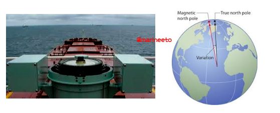
A magnetic compass works by detecting the Earth s natural magnetic fields. This allows the needle to better react to nearby magnetic fields. Since opposites attract the southern pole of the needle is attracted to the Earth s natural magnetic north pole. This is how navigators are able to discern north.
RADAR/ARPA
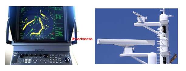
A marine radar with automatic radar plotting aid (ARPA) capability can create tracks using radar contacts. The system can calculate the tracked object course, speed and closest point of approach (CPA), thereby knowing if there is a danger of collision with the other ship or landmass. There are two bands of RADAR used onboard ship.
- X-BAND is widely used because of the ability to utilize smaller antennas that fit on most boats and to provide better target resolution. The frequency used is 9GHz.
- S-BAND is used for specialized applications, such as seeing through heavy weather or precipitation and for long-range bird detection. The frequency used is 3GHz.
AUTO PILOT
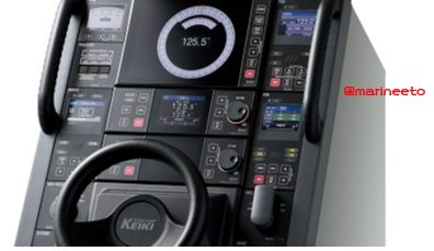
Autopilot is a Steering and Heading control system. It works on PID (Proportional Integral & Derivative) control system.
Autopilot operation is simple, put the vessel on the desired heading, hold the course for a few seconds, press AUTO, and release the helm. The autopilot will lock the course in memory, and will respond with helm corrections to keep your boat on this course.
SPEED LOG
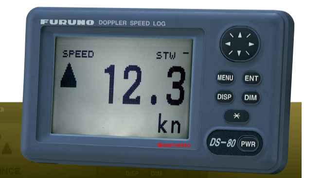
Speed log is an instrument, used in ships, to measure ship relative speed with water (in which it is traveling). The types of log widely used onboard ship are,
- DOPPLER LOG uses the principle of Doppler Effect. A pair of beam (ultrasonic waves) is transmitted in the fore and aft direction at an angle of θ to the waterline. The frequency of the received signal is compared with transmitted frequency to measure Doppler shift to calculate ship speed. The transducer used is SDME (Speed and Distance Measuring Equipment).
- ELECTRO-MAGNETIC LOG uses the principle of Faraday s Law of Electro-Magnetic Induction. An electromotive force is induced in a conductor whenever there is relative motion between the conductor and magnetic field. There is a coil in the sensor at the top of the measuring rod and the coil is energized to establish a magnetic field around the sensor. As the Ship moves an EMF is induced which is detected by a pair of electrodes at the tip of the sensor.
ECHO SOUNDER
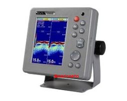
Echo Sounder consists of a transducer mounted on the bottom of the ship hull and the main unit that displays information on the depth and formation of the seabed. This information is gained by ultrasonic waves sent from transducer that are then reflected off the sea bottom and picked up again by the transducer.
Typically use 50KHz-200KHz frequency.
AIS
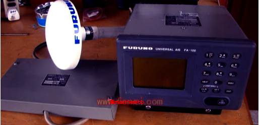
The Automatic Identification System (AIS) was originally developed to aid the Vessel Traffic Services (VTS).
AIS mainly consists of an AIS transponder, AIS Controller, and a connection box. AIS transponder communicates ship data such as ship name, type, position, SOG (speed over ground), COG (course over ground), etc, with other AIS and AIS controller displays these data via the connection box.
The frequency used is 156.025MHz to 162.025MHz.
DGPS
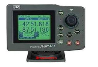
DGPS-Differential Global Positioning System is a system to improve the position fixing accuracy by receiving correct data with the beacon receiver for a given GPS satellite which is transmitted by beacon station with a known real-time position.
The frequency used in DGPS lies in L band say 1575.42MHz +/-1MHz.
NAVTEX
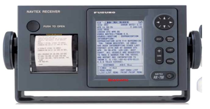
NAVTEX is known as Navigational Text Messages used on-board the vessels to provide short-range Maritime Safety Information in coastal waters automatically.
The broadcast station transmits Navigational warnings, Meteorological warnings, SAR (Search & Rescue) information, and other data for ships sailing in range. The service range is 200-400 nautical miles depending upon terrain and transmitting power.
519KHz is an international Navtex frequency and it is tuned to 490KHz for domestic or local country frequency.
ANEMOMETER & ANEMOSCOPE
Anemometer is used to measure wind speed and direction, Anemoscope is used to show the direction of the wind. It is also known as windicator.
Types of anemometer used onboard are,
- FAN/VANE type instrument is the wind direction and speed sensor, which detects a wind speed by the AC generator and detects a wind direction by the DC selsyn.
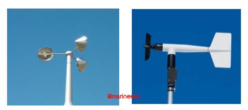
- CUP type instrument has a rotor and encoder. The wind speed sensor has a rotor with three wind cups that spin as the wind moves past the boat. The wind direction angle sensor (encoder) has a wind vane that points in the direction that the wind is coming from.
ECDIS
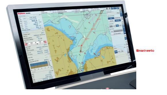
ECDIS (Electronic chart display and information system) is a geographic information system used for nautical navigation that complies with International Maritime Organization (IMO) regulations as an alternative to paper nautical charts.
It uses GPS to pin point the navigational points enhancing reliability on electronic charts. Also interfaced with other navigational equipments to get data feed from Gyro, RADAR & ARPA, GPS, Echo Sounder, Speed Log, AIS, etc.
NAVIGATION LIGHTS
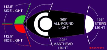
Navigation lights are used while navigating a vessel near coastal areas, in heavy shipping traffic areas, maneuvering at a harbor, or simply sailing out at the sea. They help in indicating the ship s position, status, the direction of course, etc, to other nearby vessels for avoiding collision at the sea.
ALDIS
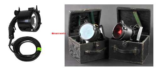
The ALDIS (All Day Light Signalling Lamp) consists of a lamp with a trigger-operated shutter that can be opened and closed. It is used for Morse code signaling-particularly between ships at sea. A halogen lamp is used (12 or 24V, 60W).
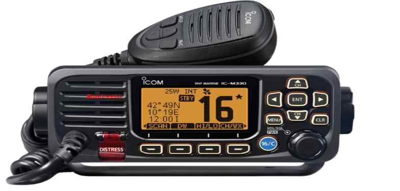
VHF
Marine VHF radio is a worldwide system of two-way radio transceivers on ships and watercraft used for bidirectional voice communication from ship-to-ship, ship-to-shore, and in certain circumstances ship-to-aircraft.
It uses FM channels in the very high frequency (VHF) radio band in the frequency range between 156 and 174 MHz.
BNWAS
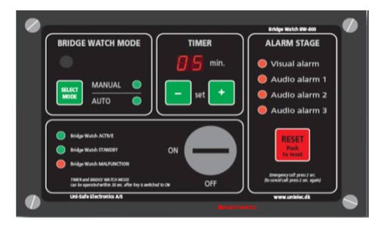
BNWAS (Bridge Navigational Watch Alarm System) periodically monitors if officers on the watch are working properly in the bridge. When the system does not acknowledge the reset operated by one of them within the set dormant period, it provides a visual indication first, and then when the system timer is not reset within 15 seconds, it provides Alarm1 (visible and audible alarm) in the bridge. When over 15 seconds pass without any reset operations, it provides Alarm2 (audible alarm) to transfer to chosen rooms such as a captain room. An officer who noticed it should go up
to the bridge to deal with the situation appropriately so that he could prevent accidents.
Furthermore, Alarm3 (audible alarm) is available on passenger ships.
Above equipment are used for Navigation & Communication purpose only. Apart from these equipment to enhance maritime safety and security below equipments are provided.
Distress signals are communicated by transmitting radio signals, displaying a visually observable item or illumination, or making a sound audible from a distance.
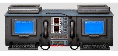
GMDSS
The Global Maritime Distress and Safety System (GMDSS) is an internationally agreed-upon set of safety procedures, types of equipment, and communication protocols used to increase safety and make it easier to rescue distressed ships, boats, and aircraft.
It uses VHF, HF, MF & One INMARSAT depending upon sea area like A1, A2, A3 & A4
EPIRB
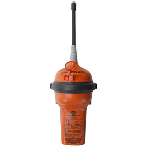
The Emergency Position-Indicating Radio Beacon (EPIRB) allows vessels to be located quickly and accurately in times of distress by transmitting distress signals.
EPIRB is small, portable, battery-powered radio transmitters that are both watertight and buoyant and transmit in the 406 MHz channel. EPIRBs are carried aboard merchant ships, some private vessels, commercial and military aircraft.
An EPIRB is designed to float in the water with its antenna pointing upright. and is required to operate for a minimum of 48 hours continuously once activated.
Two types of EPIRB used onboard, i) Portable type ii) HRU (Hydro-Static Release) type.
SART
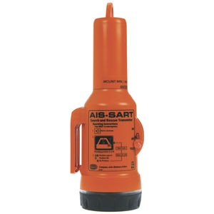
A Search and Rescue Transponder (SART) is an electronic device that automatically reacts to the emission of a radar. This enhances the visibilty on a radar screen. SART transponders are used to ease the search of a ship in distress or a liferaft.
A SART has a receiver that detects the signals from X-band radars (9.2 to 9.5 GHz). If the SART detects a signal it immediately transmits twelve pulses on the same frequency. These signals are seen in RADAR echoes.
VDR
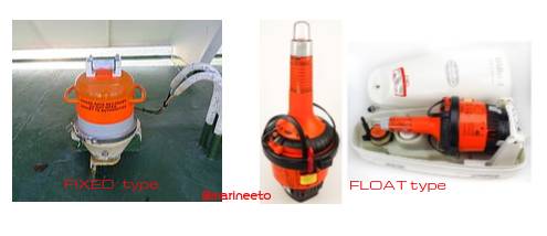
Voyage Data Recorder an electronic device on ships that records navigational status for later accident investigation (a type of black box). Two types of VDR installed onboard ship
- Fixed Protection Capsule Unit (Acoustic underwater beacon)
- Float Free Capsule Unit (EPIRB type)
Recording to these units is controlled by RCU (Recording Control Unit).
LRIT
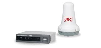
Ships must report their location to their flag administration at least 4 times a day. Most ships set their existing satellite communication system to automatically report.
SSAS
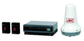
The Ship Security Alert System (SSAS) is one safety measure for strengthening ship security and subduing acts of piracy and/or terrorism against shipping.
When Security Alert System (SSAS) alert is triggered it transmits a beacon containing a specific country code, reacting to which the Rescue Coordination Centres (RCCs) or SAR Points of Contact (SPOCs) of that particular region is notified discreetly.
Missed out something? Please comment.
LIKE POST? PLEASE SHARE












If any ETO or ETR want to learn technically-Repair -Circuit diagrams for any above mentioned equipment, mail me , I will guide without any fee. blueradio26@gmail.com
I am quit new in marine field only 50 years experianc i have from Old valve to new processor base system.
Thank You Shoaib Muneer for your wonderful support.
Will contact you if we require any guidance.
Regards,
Admin
thank you so much sir for your support and sharing experience we will contact you
SYMCOM MARINE have stock navigation and comments equipment
Please contact
http://www.symcommarine.com
sales@symcommarine.com
+917984700367
Tha thank you
We provide all types of Marine Electronics and Navigational Products. New and Refurbished.
Call 8149467607
sales@ambsmarine.com
United marine is my company and we sell marine electronics equipment we would like to work with you we have large stock of equipments as your requirements if you need in future please give us chance thank you.
Ref Refurbished Equipment’s We Sales and Service Marine Communication Navigation Automation Equipment’s